
Site Context and Background
The Site
The Site is located to the immediate west of the village of Tockwith and covers an area of approximately 65 hectares. It is a predominantly brownfield site with some greenfield land surrounding it. The Site was first used by the RAF as an airfield during the Second World War between 1941 and 1945, and as an RAF base between 1946 and 1949. Since this operation ceased in 1965, the Site has been used for a variety of uses including karting, storage, and police/bus/HGV driving courses (including a skid pan).
The Site consists of two former concrete runways, associated hardstanding, agricultural land and areas of grassland. Existing landscaping comprises trees and hedging along the western and south-western boundaries. The primary access to the Site is located at the most northerly point via Fleet Lane with a secondary access from Rudgate to the west.

Site Location & Surrounding Context Plan
Click on the above image to view a larger version

Former Tockwith Airfield historical map 1964-1969
Click on the above image to view a larger version
Opportunities and Constraints
This predominantly brownfield site presents an excellent and unique opportunity to provide much-needed new homes in North Yorkshire and a significant number of new complimentary services and facilities to meet local needs, including a school, a community centre, community café, retail space, and homes for older people.
These services and facilities would complement the offer already in Tockwith and adjacent business/industrial parks, meeting gaps in the market to work alongside the services and facilities already there.
The current uses on the Site do not contribute to the residential amenity of Tockwith and are largely unneighbourly. The inclusion of public open spaces and landscaping will further improve the local environment by increasing accessible amenity areas and generating a number of social and environmental benefits.
We are aware of use of the Site for dog walking and will be looking to provide improvements in this respect to enhance informal amenity use. The scheme also has the potential to facilitate several economic benefits for the local and wider North Yorkshire community.
%20-%2016_12_25.jpg)
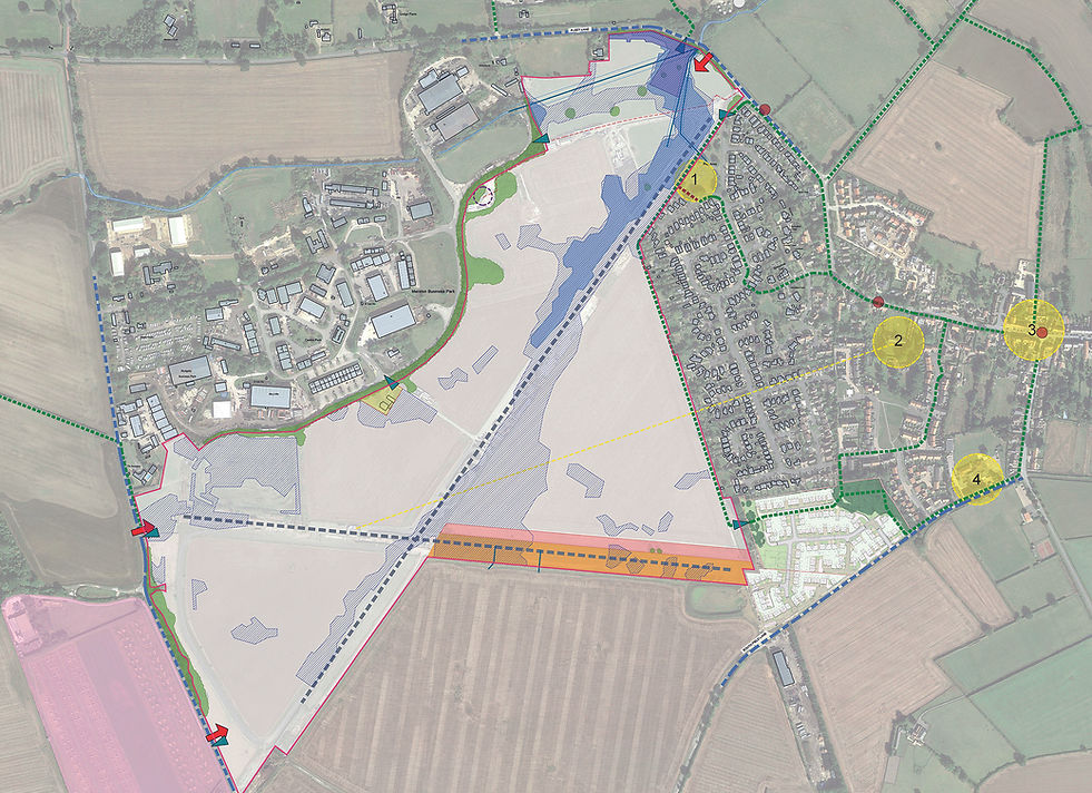
Opportunities & Constraints Plan
Click on the above image to view a larger version